Featured
2235 W Rose, Blytheville AR 72315
Nice lot on a quiet street measuring 50×150 in Blytheville, Arkansas. Priced way below area comparable sales in the area!…
For Sale
$1,950
Deals On Properties You Love | Owner Financing | No Credit | Easy Terms
Deals On Properties You Love | Owner Financing | No Credit | Easy Terms
Deals On Properties You Love | Owner Financing | No Credit | Easy Terms
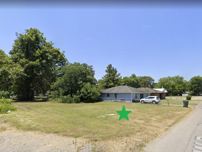
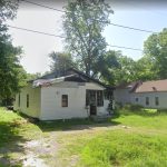
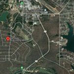
7176 Phillips Rd 300, West Helena, AR 72390, USA
For Sale
$2,300
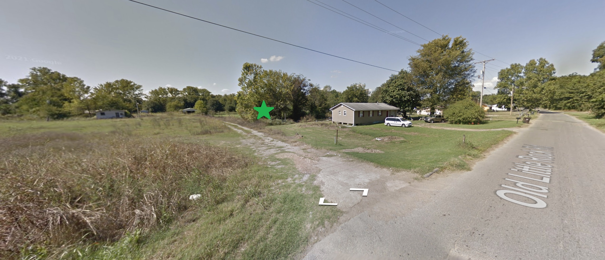


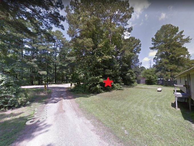
Nice unrestricted parcel off Phillips Road 300 in Helena.
Located just minutes from the Isle of Capri Casino!
Ready for your new home or hold as an excellent future investment.
Priced way below area comparable sales in the area!
GPS Coordinates are 34.530867012286876, -90.65334694091469.
Property Address: 0 Phillips Road 300, Helena, AR 72342 (Map location is approximate)
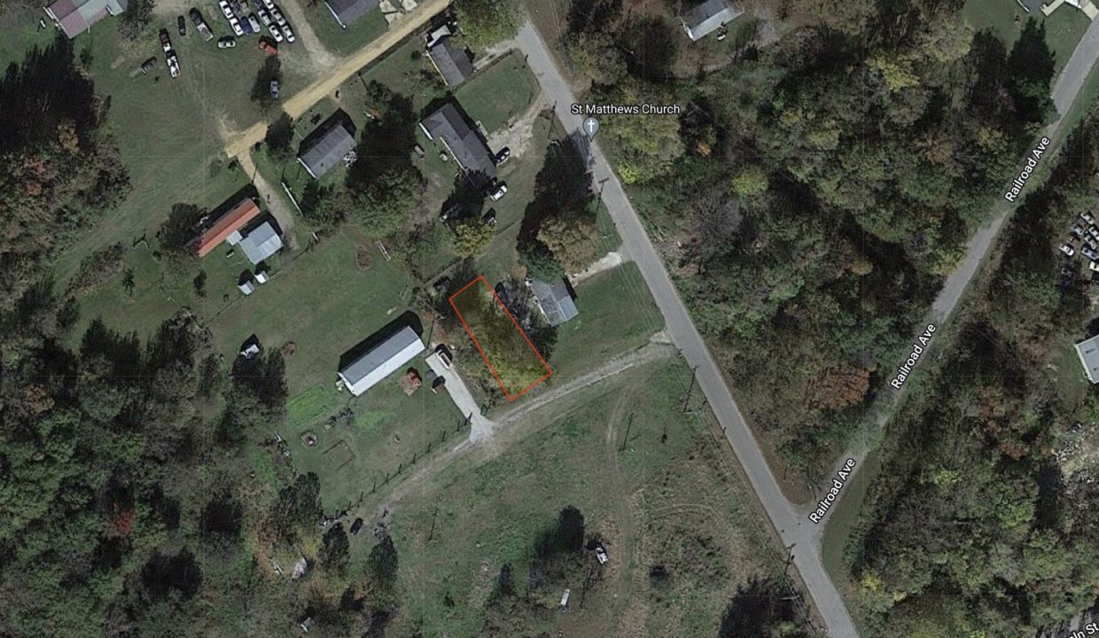
County: Phillips
Assessor Parcel Number: 001-07027-000
Legal Description:
Property located in Private Survey Number 2412, Township Two (2) South, Range Four (4) East, Phillips County, Arkansas, and more particularly described as follows:
Commencing at a point where the Northwest side of Private Survey #2412 intersects the Northeast right-of-way of the Missouri Pacific Railroad; thence South 54° East 1204.0 feet along the said right-of-way to the Southeast side of the 138 Acre Tract originally cut from the Northwest side of Private Survey 2412; thence North 54° East 2580.9 feet to the point of beginning; thence from the point of beginning, South 36° East 111.9 feet; thence South 57° West 45.6 feet; thence North 31° 13′ West 109.9 feet; thence North 54° East 36.3 feet to the point of beginning, containing 0.104 Acre, more or less.
Also: The Grantors herein grant to the Grantees a non-exclusive Easement for roadway purposes and ingress and egress over, across and along the following described tract of property, to-wit:
A 20 foot Easement located in Private Survey Number 2412, Township Two (2) South, Range Four (4) East, Phillips County, Arkansas, whose center line is described as follows:
Commencing at a point where the Northwest side of Private Survey Number 2412 intersects the Northeast right-of-way of the Missouri Pacific Railroad; thence South 54° East 1204.0 feet along said right-of-way line to the Southeast side of the 138 acre tract originally cut from the Northwest side of Private Survey Number 2412; thence North 54° East 2580.9 feet to the point of beginning; thence from the point of beginning, continue North 54° East 149.1 feet to the South line of the Little Rock Road and the end of the Easement.
Zoning: None
Annual Property Taxes: $38.00
Purchase ID : 51574 Nice lot on a quiet street measuring 50×150 in Blytheville, Arkansas. Priced way below area comparable sales in the area!…
$1,950
Nice lot located in Hardy, Arkansas near Lake Sherwood! GPS coordinates are 36.33074231115781, -91.46299003029404 Google Maps Link: Click Here Plenty of…
$1,500

No SID Fees. Nice secluded lot in Cherokee Village. Property is NOT located in the SID and is not subject…
$950
Rare corner lot located in the community of Fensenthal near the Ouachita River. Please Note: Approximate boundary lines are shown…
$2,500
 804 Cokato Road, Horseshoe Bend, AR 72512
Owning a home is a keystone of wealth… both financial affluence and emotional security.